I appreciated the chance to sleep in a proper bed and watch some TV in the Holt B&B that night (I know - a proper backpacker would use a camp site). I met a friendly couple (Robert and Becky?) there and saw them on their way out the next day in town.
This was the first "low" day I had and it felt difficult, especially late-on. The walk up along the track near General Wade's Military Road towards Whitebridge was quite steep and a bit tedious. This was broken, briefly by some nice views of Loch Ness.
 |
| View of Loch Ness from outside Fort Augustus |
 |
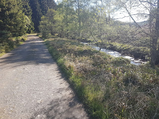
| Path alongside General Wade's Military Road |
Slightly depressingly, the roadside track ended up in a wind farm development site. It was at this point I remembered I should have phoned in the night before (how I managed to forget, I don't know). From there, I took the old road northeast, past the barren Loch Tarff area, to a high point along the side of Carn an t-Suidhe, where it was extremely windy. Just about managed to get a signal and sent a text to TGO control.
 |
| Loch Tarff. This was a bleak outlook with the high winds and overcast skies. |
 |
| Miles to go along GW's road into Whitebridge. |
Following this was a long walk down towards Whitebridge on a straight road, without any cover from the wind. I just had to press on and get to the village as fast as I could. When I got there, I actually stopped for a while in the bus shelter to eat my lunch; the only other public place offering such was an inn that appeared closed. My feet weren't too happy after pounding the roads all that time. I tried using a public phone (notice for removal given) to see if control had got my message but the keypad was broken.
 |
| The old bridge in Whitebridge. |
The final bit involved walking northeast along a minor road and then southeast through a farm, along the River E. Going southeast, through Garthbaeg farm, I met a farmer, driving something like a quad bike, who showed me on a map the location of a "lunch hut with a stove, and everything", located a bit further on from my planned camp. The last few miles of that day were extremely draining and I was feeling a bit demoralised because I was basically walking along seemingly endless windfarm access roads, that were not on my map. During this time, every half an hour, one or two large trucks would pass me by, going in both directions, and churning up the dust from the roads, which in the high winds was not pleasant; eventually, on the advice of one of the drivers, I started to walk on the windward side of the road (maybe in better spirits I would have had the sense to do that). I even saw a few very small dust devils on the roads.
 |
| Seemingly endless windfarm access roads. |
|
My planned camp site was not great as there was very little flat ground to camp on but I didn't have the energy to investigate the lunch hut (I actually wasn't totally convinced it would be where I was showed). The best I could find was on the side of the river, near the weir.
 |
| A very narrow ledge alongside the river was the only good site I could find. |
|


Comments
Post a Comment