After having successfully broken camp and washed in the river, I managed to experience a river-based-water-refilling accident resulting in partial submersion; my fleece was a bit soaked and I got some water in my boots. Fortunately, my phone is waterproof. I was glad for a bit of sun that morning, which meant things dried out fairly quickly.
It was also at around this point that I discovered a leak in my collapsible Nalgene canteen. Not sure how it happened but possibly it was sat on, in my tent. Rather foolishly, I ended up throwing it in a bin later on in the trip. As a personal note, I might bring Duck Tape next time - it would probably have dealt with the leak. My hard Nalgene was used throughout the rest of the trip - a capacity of 1L of water appears to be sufficient.
I didn't see anyone following the road out from River Doe but I did go over a deer fence that said "Deer Farm - Please Shut the Gate". Eventually the road led through Ceannacroc Lodge and there were some pleasant views of the River Morriston.
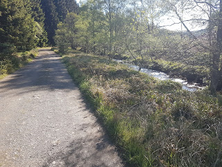
 |
| View of River Morriston from path near Ceannacroc Lodge |
After going over Ceannacroc Bridge and looking at Mackenzie's Cairn, I walked a rather tedious three miles along the A87 to the Achlain farmhouse.
 |
| Mackenzie's Cairn on the side of the A87 - a bit disappointing |
|
From Achlain, I entered on to the Old Military Road through a well hidden exit from the A87 and an old gate tied shut with rope; this was not very promising but the sign said I was in the right place. Following this "road" was quite difficult; it was overgrown and boggy for a few kilometres from Achlain and the air was very humid due to the surrounding woodland; clearly it was seldom used, even by backpackers, these days.
 |
| First section of the Old Military Road |
Late morning, I was feeling a bit low, having not seen anyone for about a day but then, to my surprise, I heard some voices some way ahead where the "road" met a wind farm access track. It turned out to be Fred, Sue, Stephan and Margret who I had met on day one. They were telling me about their ordeal the previous day, after having followed wind farm access tracks until the late evening looking for a place to camp. We set off from that point along the Old Military Road and past each other several times.
The latter sections of the Old Military Road were not existent, having been covered with wind farm access roads. However, they had put some signs up pointing to where the Old Military Road should have been. Rather than follow those signs, towards the end of the day, I foolishly decided to follow some power lines down towards the outskirts of Fort Augustus. Eventually, I realised it was making life harder, so I followed an access road out to where it rejoined the Old Military Road. This went downhill for a while along some switchbacks; I remember my feet were starting to hurt at this point - steep downhills seem to be the worst from that point of view.
 |
| Power lines and access tracks northwest of Fort Augustus |
|
|
Eventually, when I reached town, I couldn't resist the fish and chips and a sit down beside the canal, in the sun.


Comments
Post a Comment